
Trace a Cherry Hill Street
A Cherry Hill street search works best as a record chain, not as a list of everyone at an address. Begin with the address and keep the returned parcel identifiers with each result. Public assessment material can establish the parcel and recorded owner. It cannot establish a full household. The deed index then supplies the recorded transaction trail, while the voter and historical-directory layers have their own access rules and limits. Treat each result as evidence for its particular label.
- Start with the address. Normalize the street for the county assessment form, then search the known house number and base street name. Keep the full postal form separately for USPS and historical comparisons.
- Read the owner result. Copy the GPIN, situs address, owner, mailing address, legal description, subdivision and current sale details from the returned parcel. The mailing address may differ from the situs.
- Follow the deed. Use the owner and sale date in Eagle Recorder, locate the grantee record, and note the prior grantor, recording reference and legal description before working backward.
- Use voter information carefully. The Virginia portal verifies one identified person's registration after its required inputs. A street-wide voter file is controlled, not an anonymous browsing tool.
- Check the criss-cross layer. At RELIC, inspect a relevant reverse or criss-cross directory when one exists for the year. Record the edition and page with any address-to-subscriber lead.
County Mapper can be used between the parcel and deed steps to confirm the GPIN and see nearby parcel outlines. Keep unit information separate. A multi-unit address or an address range can produce more than one record.
Cherry Hill Street Directory Fields
Prince William County PublicAccessNow is the address-first starting point for the Cherry Hill street directory. Its public forms do not offer an owner-name search or a ZIP filter. Enter the base street name without a compass direction or suffix, such as a road type. For a run of addresses, use House Number and House Number High together. A result can show the parcel, ownership information, mailing and situs addresses, legal description, sale information, assessment values and property characteristics.
| PublicAccessNow field | Use on a Cherry Hill street | Format or limit |
|---|---|---|
| House Number | Locates one parcel or starts a range | Use with House Number High for a range |
| House Number High | Sets the end of a street segment | Both number fields are needed for a range search |
| Street Name | Finds the street's returned parcels | Omit direction and suffix |
| GPIN or Account# | Returns a known parcel directly | GPIN format is xxxx-xx-xxxx; an account needs six characters |
| Sale and property filters | Narrows Sales Search results | Price, date, year built, square footage, acreage, use code, style and neighborhood are available |
Owner information on a parcel card describes the ownership record. It does not prove occupancy. The county also distinguishes above-grade room and bedroom counts from finished lower-level space, a reminder to read the field label instead of treating a shorthand result as a household count.
The address-search screen shown here is the source for the address fields. It is useful for narrowing a street to the parcel records that the county actually returns.
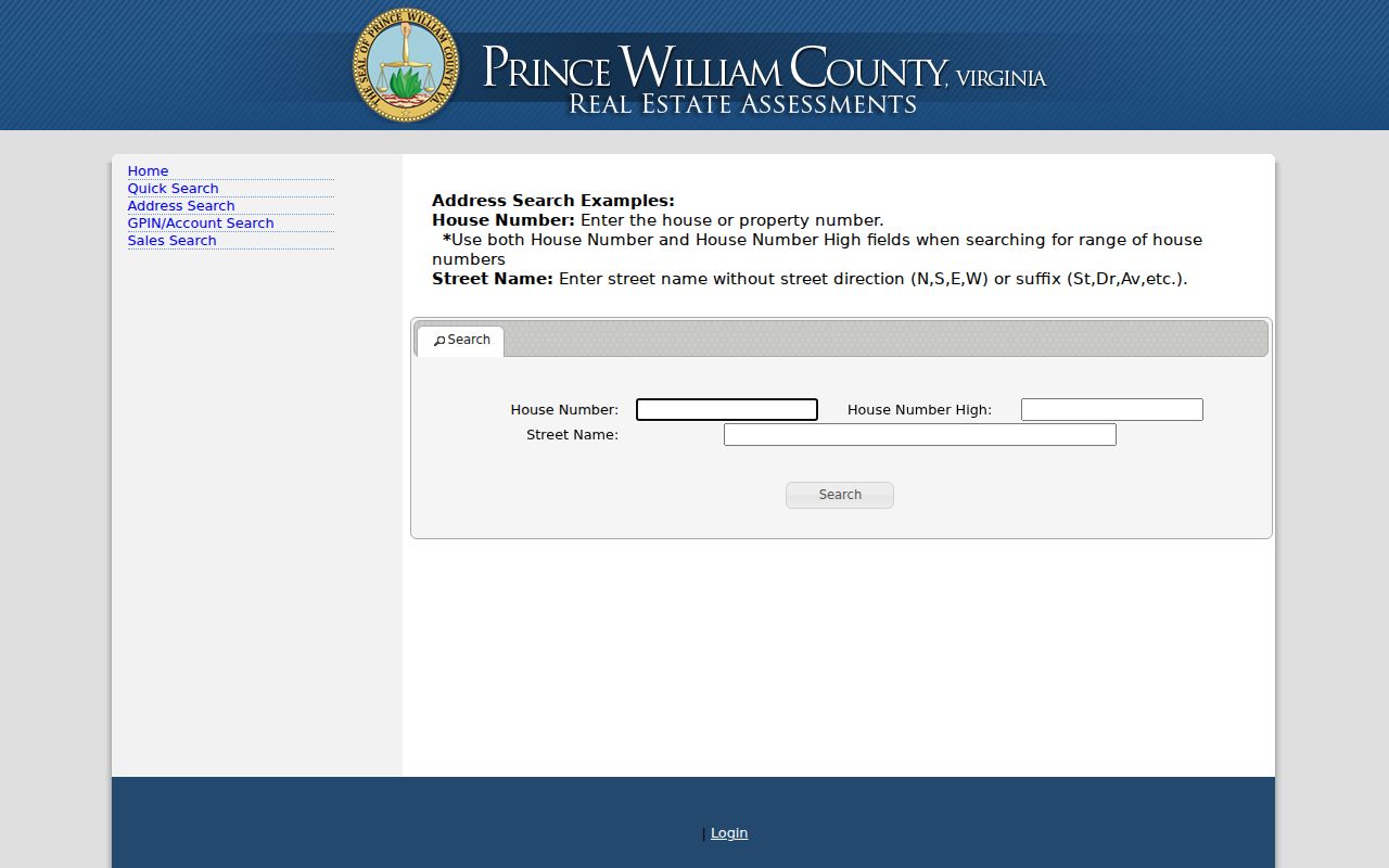
After the parcel appears, save the GPIN before moving to a map or a recorded document. That number is more stable than a postal wording change.
Map a Cherry Hill Street
County Mapper adds the geographic layer to a street directory search. It accepts a GPIN, street number and street name, map selection, intersection, coordinates and selected layers. Street Type is a separate optional control, while a unit field and a property-type toggle are available for applicable address searches. At detailed parcel scale, identify can expose an address and GPIN for enabled parcel information. The map is a research tool, not a legal description, and the county does not guarantee its accuracy.
For a named street, search the known address, turn on Land Records and Land Development, then use identify on the returned parcel. Public Services, Service Areas, Environment, Public Utilities, contours and aerial imagery can add context. For a short street segment, Buffer and Select Parcel Features can return nearby parcels around a return address. Clear the search graphics before beginning a different segment so one result does not get confused with the next.
The County Mapper application is the source for this parcel view and its search controls.
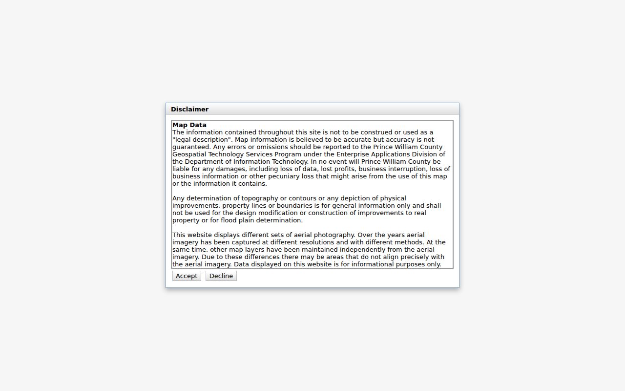
Map selection can help distinguish similarly named roads, but the GPIN and legal description should carry the record trail forward.
Cherry Hill Address Records
Different Prince William County sources answer different address questions. The assessment card, GIS parcel, deed index, permit file and old directory should not be collapsed into one label. The table keeps the record keeper, the useful output, and the access boundary in view. The street name may connect searches, but the GPIN and legal description are the stronger ties between parcel, plat and deed.
| Address record | Custodian | Useful Cherry Hill result | How to reach it |
|---|---|---|---|
| Assessment parcel | Real Estate Assessments | Owner, mailing/situs distinction, legal description, value and sale data | PublicAccessNow; office and phone access |
| GIS parcel | Geospatial Technology Services | Parcel geometry, address, GPIN and public layers | County Mapper browser map |
| Deed or plat | Circuit Court Clerk | Parties, recording date, instrument reference and legal description | Eagle index, clerk terminal, historic research channels |
| Development file | Development Services Records Center | Plans, permits, zoning or land-development dates | Records Center or a specific Virginia FOIA request |
| Voter record | Virginia Department of Elections | Individual status and election information after required identity inputs | Citizen Portal; controlled voter-list request |
| Criss-cross directory | RELIC | Address-to-subscriber or household-head lead for an edition | On-site books and telephone directories |
A permit can date construction, an addition, road access, or a change in use. It is not a household roster. The Records Center at 5 County Complex Court, Suite 20, can confirm what it holds; its public pages did not expose a complete searchable address index. A reasonably specific Virginia FOIA request is a fallback when a releasable county file is not directly supplied.
Follow Cherry Hill Deeds
The Eagle Recorder occasional-user route is the recorded-owner layer for a Cherry Hill street directory. Its free index covers deeds and related land records and plats from January 1, 1918 forward. Search a current owner as grantee near the known sale date, then use the purchase record to identify the seller, prior reference and legal description. Search that seller as a grantee for the earlier acquisition. A grantor transfers an interest; a grantee receives it.
For a document image, the occasional-user price is $0.50 per image plus a $2 internet convenience fee. Clerk public terminals avoid the convenience fee and charge $0.50 per copy. Remote subscription access is another channel, and historic remote use is agreement-based through the Historical Online Portal. The Circuit Court Clerk's Office at 9311 Lee Avenue in Manassas, the Historical Document Room, RELIC and Library of Virginia microfilm are the documented fallbacks for older or incomplete material. A certified copy comes from the clerk, not an historic web image.
The Eagle access page documents its free index, image charges and coverage. It is the source for the recorder view below.
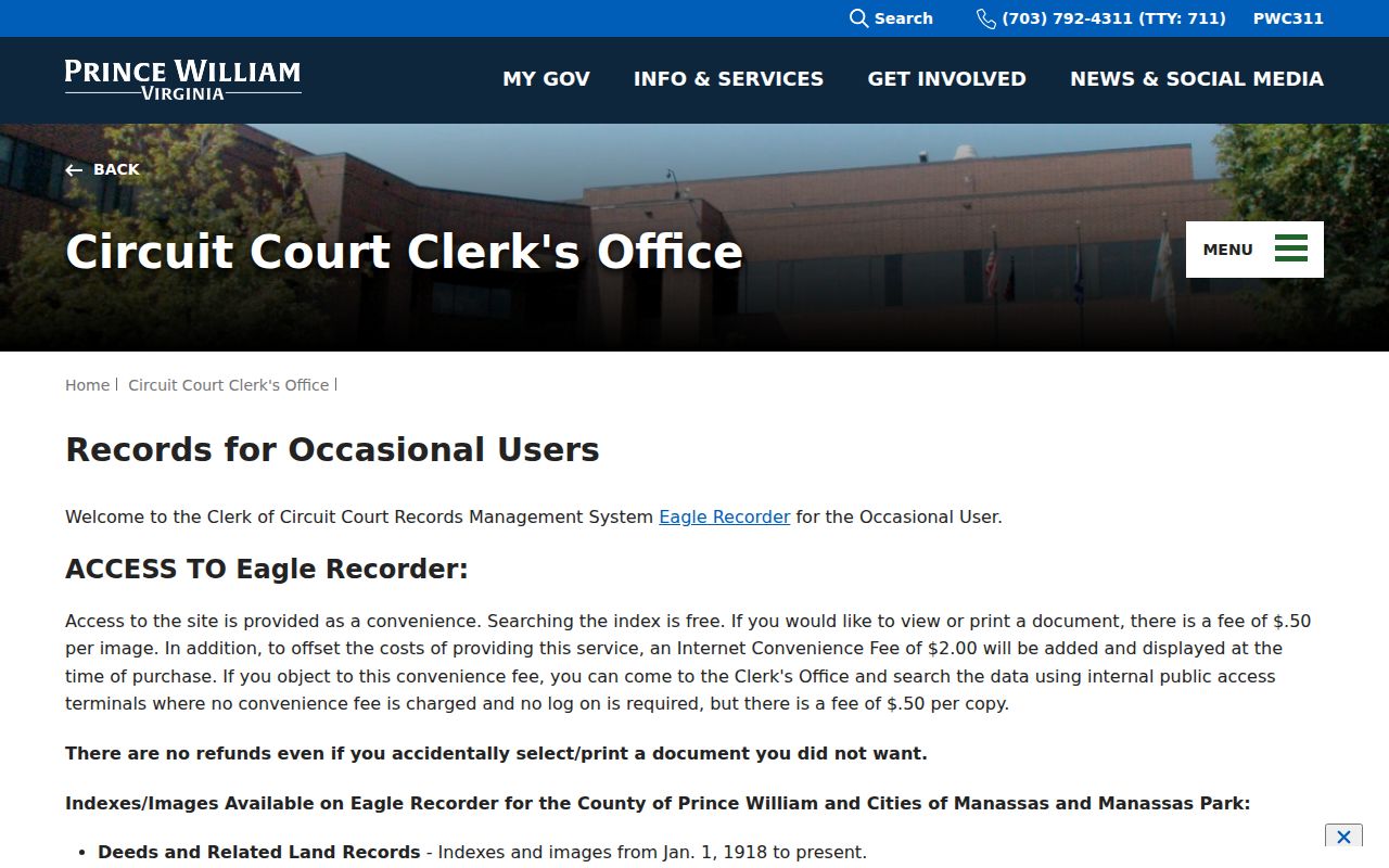
Record the book and page or instrument number even after saving an image. It lets the clerk or a research room retrieve the same item later.
Cherry Hill Street Record Terms
Four small terms keep an address search from taking on a meaning the source does not support. They also make it easier to compare current county systems with older paper or microfilm material.
- Parcel
- A defined piece of land in the county's assessment and map systems, usually identified by a GPIN.
- Situs address
- The address where the parcel is located. It can differ from the owner's mailing address.
- Plat
- A recorded map that can show a subdivision, lot, block, easement, right-of-way or road alignment.
- Criss-cross directory
- An address or phone-organized section of a directory, when that edition includes one, used to find a subscriber or household-head lead by location.
For a longer historic address trail, the Cherry Hill City Directory concentrates on the RELIC collections and how to cite their editions. The street work here remains focused on moving from a current address to the right county and archival sources.
Cherry Hill Voter Boundaries
The Virginia Department of Elections Citizen Portal is an individual status tool. It asks for name, date of birth, last four digits of the Social Security number, locality and a certification box. The result can show registration status, polling place, district, absentee status and voting history. It is not an open street directory, and Virginia does not register voters by party.
The full voter-list process is separate. The Department's request form allows filters such as locality, district and election, but it requires a listed requester category and a signed use and responsibility statement. A local fallback is the Prince William Office of Elections at 9250 Lee Avenue, Suite 1, Manassas, or the Department's voter-status guidance. Historical registration records are not an online Cherry Hill street database; RELIC and state-library county election microfilm are the documented research routes.
Note: A voter-status result confirms only what the authorized system reports for the identified registrant, not every person at the address.
Cherry Hill Criss-Cross Leads
RELIC at Central Library holds the historical address layer that a current Cherry Hill street directory cannot supply. Relevant shelf runs include Manassas directories from 1960 through 1983, Quantico, Triangle, Dumfries, Woodbridge and Occoquan regional directories from 1963 through 1980, and Prince William County issues for 2001 and 2007 through 2020. Regional telephone books run from 1958 through 2009 with a few gaps. A reverse section is issue-specific, so confirm that the selected volume actually has one.
Begin with the alphabetic listing if a probable name is known, then inspect reverse or criss-cross pages for the address. Local directories may show a head of household, address, occupation, spouse notation, a telephone number, or a tenure notation, depending on the publisher and edition. They do not prove a current household or deed ownership. RELIC is at Central Library, 8601 Mathis Avenue, Manassas; call or email ahead when consulting fragile or uncataloged material.
Cherry Hill Postal Name Clues
Cherry Hill was an older Potomac and Neabsco corridor settlement before it became a modern CDP label. The local post office declined after Rural Free Delivery, better roads, automobiles and postwar consolidation. Older research can therefore appear under Cherry Hill, Neabsco, Dumfries, Occoquan, a magisterial district, a rural route, or a neighboring village. A failed search under the present postal city is a reason to try those documented historical headings, not a reason to assume the record is absent.
The 1992 historical map index at RELIC is especially useful for alternate place and road names. Compare an old heading against a legal description, adjacent owners, plats and the GPIN before deciding it refers to the same location. A postal label is useful for delivery; it is not the county's legal parcel key.
Cherry Hill's 1918 Record Line
The January 1, 1918 online deed and plat cutoff is a practical number for Cherry Hill street research. Eagle also has separate later starts for fiduciary material, fictitious names, judgments and UCC filings. A clean online result after the cutoff can shorten the path. Earlier work often requires the Historical Online Portal, clerk terminals, the Historical Document Room, RELIC, Library of Virginia microfilm or a catalog search for surviving material.
Many pre-Civil War Prince William records were lost, destroyed or stolen in 1863. A missing early deed is not proof that an address had no history. Surviving deed books or abstracts, tax material, wills and heirs, church or cemetery records, newspapers and archival microfilm can provide substitute evidence. Keep the source and the gap in the research notes rather than filling it with an assumption.
Cherry Hill Property Alerts
Prince William's free Property Alert System is a current addition to the street-record workflow. Launched April 23, 2025, it can create alerts keyed to a parcel ID or owner name. An alert reports the document type, reference number, recording date and time, and a document link. There is no stated limit on alerts. It can help a recorded owner monitor a parcel, but an alert is not proof that a document is valid or that a person lives there.
Use the official Property Alerts page to enroll or verify an alert. A suspicious recording should be checked with the Circuit Court Clerk, an attorney, and law enforcement as appropriate. Do not treat an alert message as a bill.
Cherry Hill Street Directory Limits
A street directory can identify recorded owners, parcel facts, a directory entry, or a verified voter record through its proper channel. It cannot enumerate every person in a dwelling. Roommates, children, guests, utility customers and protected people may not appear in public materials. DMV address information is restricted by the federal Driver's Privacy Protection Act. Address Confidentiality Program participants must not be reverse-engineered from public records.
Virginia law also protects juvenile, adoption, sealed court and restricted vital material. Correct an assessment entry with the assessor, a deed-index issue with the clerk, or voter information with the elections registrar. For county records not otherwise available, Virginia FOIA permits a reasonably specific request and generally requires a response within five working days, subject to exemptions and allowed actual costs.
Lawful use. Use Cherry Hill address records for lawful personal, family-history, civic, or records-verification purposes. Virginia's stalking and computer-harassment laws prohibit using public information to follow, threaten, contact, or harm another person.