
Cherry Hill ZIP Code Coverage
Cherry Hill is a Census-designated place in Prince William County, not an incorporated city with its own postal or records office. The Census profile associates the CDP with two ZIP Code Tabulation Areas, 22026 and 22191. A ZCTA is a Census approximation of ZIP geography. It is useful for place-level context, but it is not a house-by-house USPS assignment. The listed postal city is a delivery label, not evidence that a parcel lies in an incorporated town or outside the CDP.
| ZIP | Areas Covered | Post Office | Notes |
|---|---|---|---|
| 22026 | Part of the Cherry Hill CDP context and adjacent Dumfries and Potomac corridor addresses | Dumfries, Virginia | Verify every street address with USPS; the delivery boundary is not a CDP, town, or county line. |
| 22191 | Part of the Cherry Hill CDP context and adjacent Woodbridge and Potomac corridor addresses | Woodbridge, Virginia | A Woodbridge mailing address can be outside the CDP, and a Cherry Hill address can use a neighboring postal city. |
No additional ZIP serving the Cherry Hill CDP was identified in the inspected Census profile. That does not make either entry a shortcut for every address. USPS, not a ZCTA table, assigns the deliverable ZIP for a particular home or unit.
Verify Cherry Hill ZIP Codes
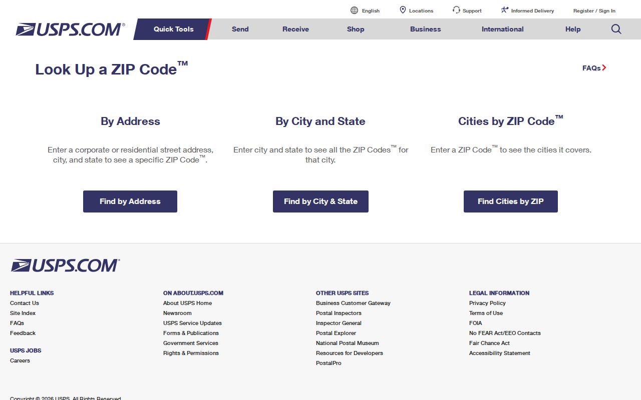
The USPS ZIP Code Lookup is the primary verifier for an exact Cherry Hill address. Its inspected By Address mode requires a street address, city, state, and ZIP when known, then returns the standardized postal city and ZIP. Enter the full current address, including a unit when it matters. Keep that standardized result beside the county parcel result, because a street can cross a postal boundary and a postal city does not replace the county jurisdiction.
| USPS field | How it is used | What the result supports |
|---|---|---|
| Street address | Identifies the delivery location | Address-specific postal routing |
| City | Supplies the postal locality for the query | Standardized postal-city response |
| State | Sets the state for the lookup | Virginia delivery result |
| ZIP when known | Helps verify an existing postal form | Confirmation or correction for the address |
The USPS address-to-ZIP screen is the source for the lookup described here.
A valid postal result confirms mail routing for that entered address. It does not confirm a city limit, a recorded owner, or the people associated with a parcel.
Search One Cherry Hill ZIP
A useful ZIP workflow starts with the precise address because Prince William's property and map portals do not expose a ZIP-wide public browse. A ZIP can narrow a private research list only where the custodian permits that use. It cannot replace checking each parcel. The county retains the local property and land records for Cherry Hill regardless of whether the mailing label reads Dumfries or Woodbridge.
- Verify the address with USPS. Save the standardized postal city and ZIP for the known street address or unit.
- Normalize the county search. Use the house number and base street name in PublicAccessNow, or use a known GPIN. Do not expect a ZIP filter.
- Confirm the parcel. Use County Mapper with the address or GPIN and compare the returned parcel to the county assessment record.
- Use election records only through their stated channel. The Citizen Portal is an individual status tool; controlled voter-list products use locality, district, and election filters rather than a casual ZIP browse.
- Move to the street when needed. After an address is verified, trace the parcel and deed evidence by street rather than assuming every address sharing a ZIP has the same record history.
The Cherry Hill Street Directory supplies the address-to-parcel, owner, deed, voter, and historical-directory sequence once a ZIP has narrowed the place to a specific street.
Cherry Hill ZIP Portal Fields
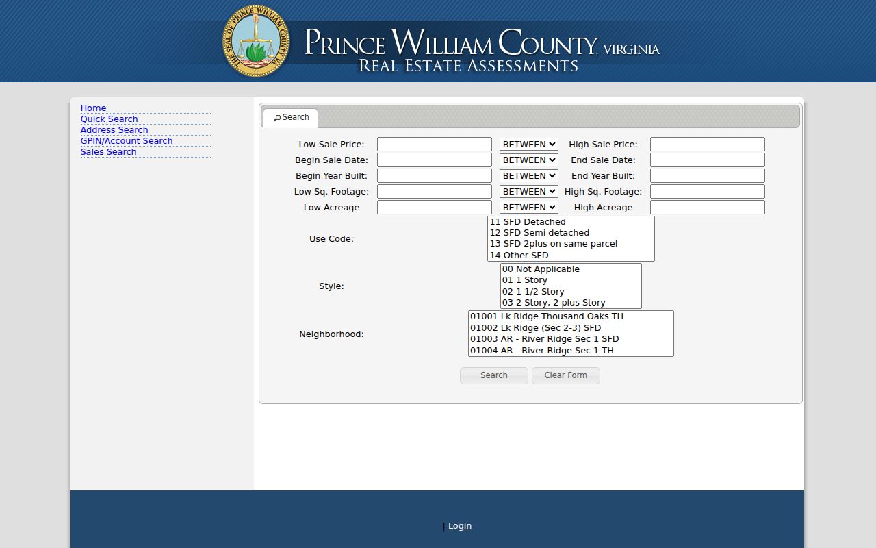
PublicAccessNow and County Mapper are valuable after USPS verifies the address, but neither inspected public form offered a ZIP field. PublicAccessNow accepts address, GPIN or account, and sales-search fields. County Mapper accepts an address, GPIN, map selection, intersection or coordinates. The absence matters: a Cherry Hill ZIP code directory should not promise a county-owned ZIP search that the live forms do not display.
| Portal | Supported query | ZIP capability inspected | Best use after USPS |
|---|---|---|---|
| PublicAccessNow | Address, GPIN/account, sales filters | No visible ZIP filter | Find the parcel, owner information, situs, legal description and sale fields |
| County Mapper | Address, GPIN, map, intersection, coordinates and layers | No visible ZIP field | Confirm parcel geometry, address, GPIN and public layers |
| Citizen Portal | Name, date of birth, last four SSN digits, locality and certification | No public ZIP browse | Check an identified person's registration status and election information |
| Voter-list request | Locality, district, election and other authorized parameters | Not a simple ZIP product | Use only through the qualifying request process and responsibility statement |
The PublicAccessNow Sales Search is the source for the visible advanced fields. It includes price, sale-date, year-built, square-footage, acreage, use-code, style and neighborhood filters, but no ZIP filter.
That distinction keeps a postal lookup from being mistaken for a county assessment search. Use each system for the geographic key it actually accepts.
Keep the Cherry Hill GPIN
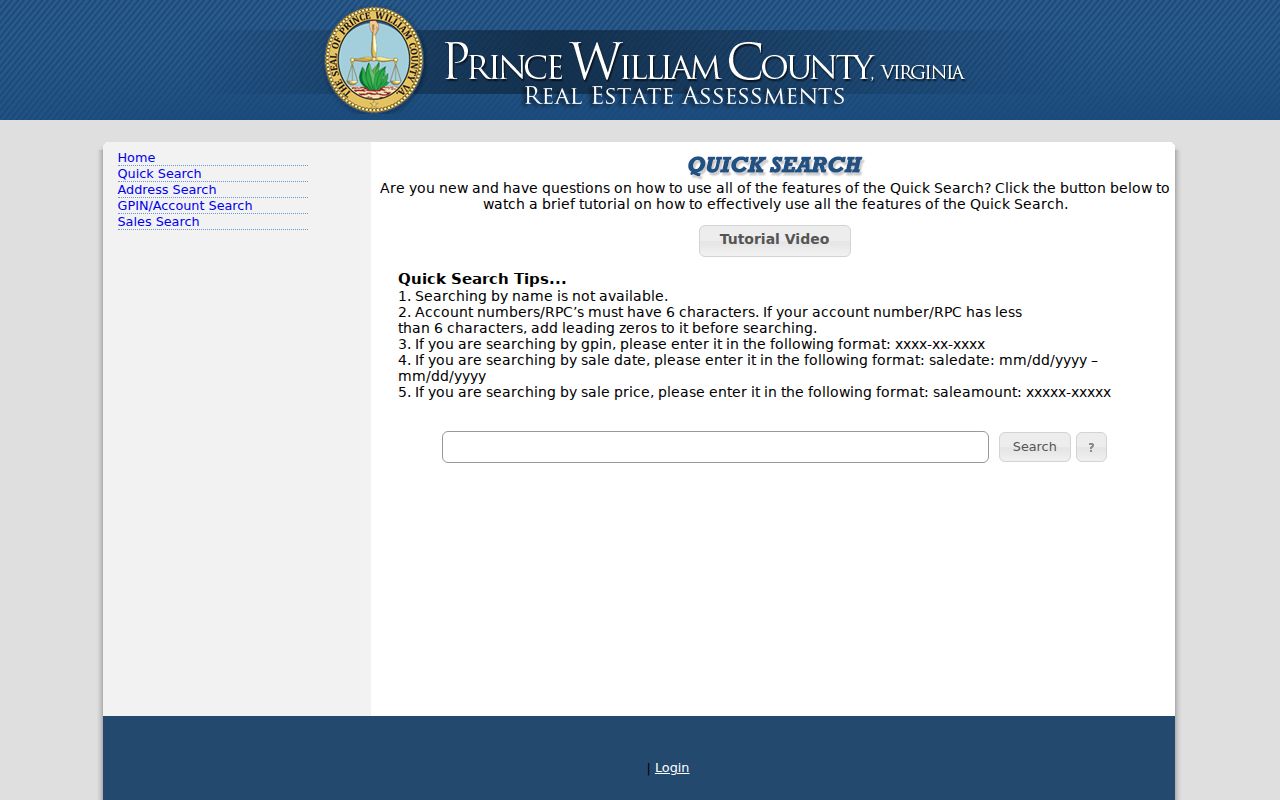
The GPIN is the stable bridge between a Cherry Hill parcel map, assessment record and deed. Prince William County formats it as xxxx-xx-xxxx. A full postal address can change in spelling, ZIP, postal city, or historical heading, while the parcel identifier and recorded legal description provide a firmer way to compare the same land. PublicAccessNow also accepts an account or RPC value, but it must have six characters, with leading zeros added when necessary.
A recorded plat can add the subdivision, lot and block, easements, right-of-way and road alignment. A deed can use a metes-and-bounds description or a plat reference. Neither a parcel map nor a ZIP result is itself the legal description. Cherry Hill Crossing Condominium appears in the county subdivision directory, a useful development and plat lead rather than a list of occupants.
The PublicAccessNow Quick Search page illustrates the address and GPIN route used after a postal address has been checked.
Save the GPIN with the verified address and document reference. That small record set keeps later parcel and deed searches aligned.
Cherry Hill Postal City Limits
ZIP boundaries, the Cherry Hill CDP, Prince William County and parcel lines are four different geographies. A Dumfries or Woodbridge mailing city does not turn a Cherry Hill address into an incorporated city address, and it does not change the county clerk or assessor that holds the relevant record. The exact ZIP must be confirmed by delivery address, especially where a road crosses the 22026 and 22191 areas.
County Geospatial Technology Services, Development Services and county address-validation functions handle local addressing matters. No current Cherry Hill street-renaming or readdressing history was found in the inspected sources, so an old address should be bridged by legal description, historic road names, adjacent owners, plats and GPIN information rather than an assumed renumbering date.
Cherry Hill ZIP Code Terms
Postal language is easier to use when the terms are kept distinct. These definitions describe routing and directory research, not a claim about a particular residence.
- ZIP code
- A USPS delivery-routing code assigned to an address or postal service area. It is not a municipal boundary.
- ZIP+4
- An added four-digit segment that helps USPS route mail more precisely within a ZIP code.
- PO-box ZIP
- A ZIP used for post-office box delivery. It should not be assumed to identify a street-delivery area.
- Unique ZIP
- A ZIP assigned for a particular organization or delivery purpose. No such Cherry Hill ZIP was identified in the inspected sources.
- Carrier route
- A delivery sequence used by USPS within a postal area. It is not proof of a CDP, parcel, or city-limit boundary.
Cherry Hill's Two ZCTA Links
Cherry Hill's Census profile recorded 23,683 people in the 2020 Census, up from 16,000 in 2010, and identifies the CDP with the 22026 and 22191 ZCTAs. Those figures describe the Census place and postal-area association, not a resident roll. The CDP had 7.80 square miles of land in the same profile. They are useful only as a reminder that the locality spans more than one postal context.
For a postal search, the address result carries more weight than the broader ZCTA link. For a property record, the county parcel and GPIN carry more weight than either. Keeping those roles separate prevents a ZIP map from being used as a substitute for a land-record search.
Historic Cherry Hill Postal Names
Modern ZIP terms disappear in older source material. Historic Cherry Hill was a Potomac and Neabsco corridor settlement whose post-office identity declined after Rural Free Delivery, improved roads, automobiles and postwar consolidation. Older directories, maps and county records may file a person or place under Cherry Hill, Neabsco, Dumfries, Occoquan, a rural route, a magisterial district or a nearby village instead of the present CDP label.
RELIC's historic-map index records alternate place and road names by grid and quadrant. Its local and regional directories and telephone books provide another route when a contemporary postal search has no answer. Read the old place name against the legal description and adjacent landowners before treating it as the same address.
Note: A historic place name can improve a catalog search, but it does not establish a modern USPS ZIP assignment for the location.
Cherry Hill ZIP Research Limits
A ZIP code directory can sort postal geography. It cannot supply a public county roster for every address in that ZIP. The voter portal verifies an identified person's own record through required inputs, while full voter-file products use controlled request rules. PublicAccessNow does not support an owner-name or ZIP search, and County Mapper does not offer a ZIP-wide public browse. Historical directory entries are issue-specific and can omit rural households or non-subscribers.
Use a verified address for property, deed and map research, then request records from the correct custodian when a documented channel is needed. Virginia FOIA permits reasonably specific requests for existing county records and normally requires a response within five working days, subject to exemptions and actual-cost charges. Protected addresses, sealed or juvenile court material, restricted vital records, and DMV information remain outside an ordinary address-search workflow.